Introduction of the Road Plan
Road plays a vital role in the economic development of road transport in India. Road Transport is one of the easiest, convenient, and economical modes of transportation. Roads also play an important role in the defence as well as in the cultural progress of our country.
Highway Development and Planning

Planning, or highway planning in india, is one of the most important things before starting any project. It is the basic requirement for the development and construction of highways. Highway Development and Planning is very important in the overall development of the country.
It deals with the planning, Development, traffic operation and control, Pavement Design, Construction and maintenance of roads.
The Necessity of Highway Planning
The necessity of Highway Planning are as follows
- Highway planning is very important for planning an efficient network of the roads and for Safe traffic operations.
- To plan for the future requirements and the Developments of the roads in the country.
- To plan for Construction and maintenance of various types of the road network.
- To work out the financing system.
Formation of Road Development Plan

After the End of the First World war, the demand for a better road network, especially considering the formation width of road, is increased. The existing roads in India are not capable of heavy traffic and transportation. It is a need that there should be a good road Development Plan which will help in the overall development of India.
The Indian legislature passed the legislature for the appointment of the committee in order to examine and make a detailed report on the development of roads in India.
Nagpur Road Plan
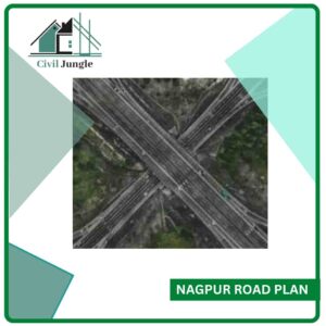
The first 20 year road plan is also popularly known as Nagpur Road plan, which many refer to when discussing what the nagpur plan is associated with. For development and construction of roads to the government took a conference of chief engineers at Nagpur in 1943. The conference, held in nagpur plan 1943, is popularly known as the Nagpur road plan.
Nagpur road plan is the first attempt for the road development programme. The construction and the development of the roads were assigned to the central government of India.
The target road length in the Nagpur road plan is 16 km per 100 square km area of the country. The Nagpur road Development Plan was planned for a time period of 1943-1963, but it was achieved two years before. The target road length in the Nagpur road plan is 5,32,700 km.
The pattern which is used in the roads for nagpur road plan is based on. The Development allowance for Nagpur road plan is 15%.
The salient features of nagpur road plan include its classification of roads as follows
- National highway(NH)
- State highway(SH)
- Major District Roads(MDR)
- Other District Roads(ODR)
- Village Roads(VR)
1. National Highways (NH)
National Highways are the main highways which run through the length and breadth of India and join the main parts, capital of states, and large industrial and tourist centres which includes various roads required for a strategic moment for the defence of India.
The Road width varies from 7 m to 15 m for the National highways in India. All the National highways are assigned with the numbers for example
Amritsar-Ambala-Delhi Road-NH1
Agra-MumbaiRoad-NH3
2. State Highways (SH)
The Highways linking up with the National Highways of adjacent States district headquarters and important cities with the states are known as state highways. The responsibility of construction and maintenance of the state highways taken by State Government.
The geometry design specifications and design speed for National Highways and State Highways are the same. The length of state highway roads varies from 7 m to 10 m.
3. Major District Roads (MDR)
The major district roads are one of the important roads which are located within the district. It serves an area of production and Markets and connecting these places with each other or with the main highway.
The responsibility for construction and maintenance of major district roads are associated with district authorities. The state government gives grants for the development of major district roads.
4. Other District Roads (ODR)
The roads serving ruler areas of production and providing them with market centres, headquarters, and block development headquarters, railway station, etc are known as Other district roads.
5. Village Roads (VR)
The roads connecting villages or groups of villages with each other or with the nearest role of the higher category are known as village roads. Village roads place a very important role in the development of rural areas.
Bombay Road Plan
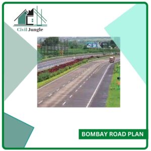
Bombay city is the capital of Maharashtra state. It is one of the metropolitan and second most populated cities in the world. So that is very essential that there should be proper road Development plan should be planned and implemented. The 2nd 20 year road plan, also known as the Bombay Road plan, was initiated by IRC (Indian Road Congress) in the year of 1959.
This second twenty-year road development plan was finalised for the period of 1961-1981. It was popularly known as the Bombay Road plan. The Development allowance for the Bombay road plan is of 5%.
The targeted road length for the Bombay road plan is almost double as compared to the Nagpur road plan. The total length of the Bombay road plan is 10,57,330 km or 32 km per 100 square km. The Construction of the Express way of about 1600 km is also included in the Bombay road plan.
Lucknow Road Plan
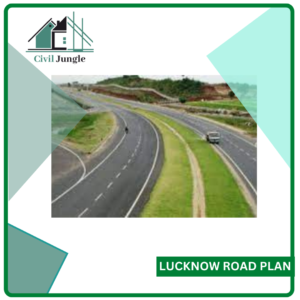
The 3rd 20 year road plan, also known as the Lucknow Road Plan, was prepared by the Road wing of Ministry of shipping and Transport with the co-operation of various experts and organizations in the field of highway engineering and transportation. The third-year road Development plan was finalized for the time period of 1981-2001. It was popularly known as a road plan.
The targeted road density of the Lucknow road plan is 82 km per 100 square km. The pattern which is used in the third year road Development Plan is Square and block pattern.
There is no Development allowance is given for the third 20-year road Development Plan. In this road plan, there was great importance given to the energy conversation, environmental quality of the roads, and the safety measures.
Objectives of Lucknow Road Plan
- The main objective of the Lucknow road plan is to connect the main cities and provide a fast-moving corridor to minimize travel time.
- To reduce pollution and carbon footprint of vehicles that are travelling between Lucknow and Agra.
- To enable farmers in Uttar Pradesh to move agricultural and other horticultural products rapidly to the main cities.
- For the efficient and safe movement of traffic on the roads.
Classification of Roads as Per the Third Road Development Plan
According to the third road development plan, the roads in the country are classified into three types for the purpose of transport planning, functional identification and assigning priorities on the road network.
- Primary System.
- Secondary System.
- Tertiary System.
1. Primary System
Primary system is as follows.
Expressways
Expressways are a separate class of highways which has superior facilities and design standards. Expressways have a very high volume of traffic. These highways only permit fast-moving vehicles. The construction and maintenance of these roads are associated with the central government or state government depending upon the type of roads.
2. Secondary System
Secondary system are as follows.
2.1. State Highways (SH)
This road can carry medium to fast level traffic. The roads having width varying from 7 m to 10 m which connects the national highways and the district places in the states are known as state highways (SH).
2.2. Major District Roads (MDR)
The major district roads are the roads which connect one district to another district. The design speed of vehicles on major district roads is less as compared to highways.
3. Tertiary System
Tertiary system are as follows.
3.1. Other District Roads (ODR)
The roads which connect each main district place to the taluka place are known as district roads. The width of this roads varies from 5 m to 8 m.
3.2. Village Roads (VR)
The roads which connect any village to the district road are known as village roads. This type of roads is made up of earth materials where only light traffic is allowed.
Road Development Plan of Various Cities in India
Pune Road Plan

The Pune Road plan comes into existence in 2007. The main aim of the Pune road plan is to boost the connectivity in the city and suburban areas. It was planned to be implemented in four phases and the total estimated cost of the project is Rs 17,328 crores.
Jaipur Road Plan

The transportation of Jaipur mainly depends on the roads. The Master Development Plan for the Jaipur region was prepared by Jaipur Development Authority. It functions in providing good road infrastructure.
Chennai-Bengaluru Road Plan
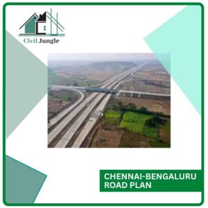
Chennai-Bengaluru expressway is a green-field project with a proposed closed toll system. There are two roads that connect the capitals of states like Tamil Nadu and Karnataka. The project cost of Chennai-Bengaluru is Rs 20,000 crores.
Delhi Road Plan

Delhi is the capital of India and it is essential to have good road transport in Delhi. The government is planning for the redevelopment of nine roads in Delhi. The estimated cost of this project is Rs 400 crore.
There are also various road plans in India like Surat road plan, Hyderabad road plan and Ahemdabad road plan which are working for the development and establishing strong road network in India.
FAQ: Strategic Road Development in India
Why is road development crucial for India’s economic growth?
Road development is vital for India’s economic growth as it facilitates efficient transportation of goods and people, enhances trade, supports defense logistics, and promotes cultural exchange. Well-planned roads reduce travel time and costs, boosting overall economic productivity.
What is highway development and planning in India?
Highway development and planning involve the strategic design, construction, and maintenance of road networks. It includes traffic operation and control, pavement design, and ensuring the road network meets current and future transportation needs efficiently.
Why is highway planning necessary?
Highway planning is essential to create an efficient and safe road network, anticipate future requirements, ensure proper construction and maintenance, and develop a sustainable financing system for road infrastructure.
What was the significance of the Nagpur Road Plan?
The Nagpur Road Plan was the first systematic road development program in India, initiated in 1943. It aimed to create a comprehensive road network with a target road length of 5,32,700 km. This plan set the foundation for subsequent road development strategies in India.
What are the key features of the Nagpur Road Plan?
The Nagpur Road Plan classified roads into categories such as National Highways (NH), State Highways (SH), Major District Roads (MDR), Other District Roads (ODR), and Village Roads (VR). It set a target road density and introduced a development allowance to ensure systematic road construction and maintenance.
How did the Bombay Road Plan differ from the Nagpur Road Plan?
The Bombay Road Plan, initiated in 1959, targeted a road length of 10,57,330 km, almost double that of the Nagpur Road Plan. It emphasized the construction of expressways and aimed for a road density of 32 km per 100 square km, compared to Nagpur’s 16 km per 100 square km.
What was the focus of the Lucknow Road Plan?
The Lucknow Road Plan, finalized for 1981-2001, focused on connecting major cities with fast-moving corridors, reducing travel time, minimizing pollution, and enhancing road safety. It targeted a road density of 82 km per 100 square km and emphasized energy conservation and environmental quality.
How are roads classified under the third road development plan?
Under the third road development plan, roads are classified into three systems:
- Primary System: Includes expressways with high traffic volume and superior facilities.
- Secondary System: Comprises State Highways (SH) and Major District Roads (MDR), connecting districts and states.
- Tertiary System: Consists of Other District Roads (ODR) and Village Roads (VR), serving rural and local areas.
What are some significant city-specific road development plans in India?
Significant city-specific road development plans include:
- Pune Road Plan (2007): Aimed at boosting connectivity in the city and suburban areas with an estimated cost of Rs 17,328 crores.
- Jaipur Road Plan: Prepared by the Jaipur Development Authority to enhance road infrastructure.
- Chennai-Bengaluru Road Plan: A green-field expressway project with an estimated cost of Rs 20,000 crores.
- Delhi Road Plan: Redevelopment of nine roads with an estimated cost of Rs 400 crore.
What impact do these road development plans have on the country?
These road development plans significantly improve connectivity, reduce travel time, enhance safety, promote economic activities, support defense logistics, and facilitate regional development. They play a crucial role in India’s overall growth and infrastructure development.